Shades of Sunset Blvd.
2021
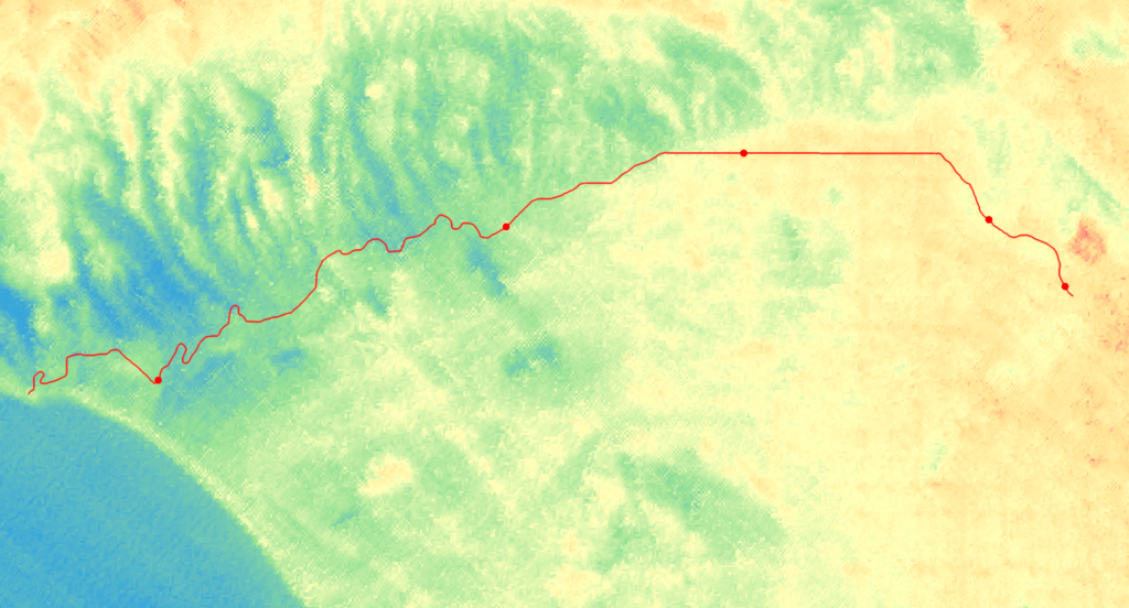
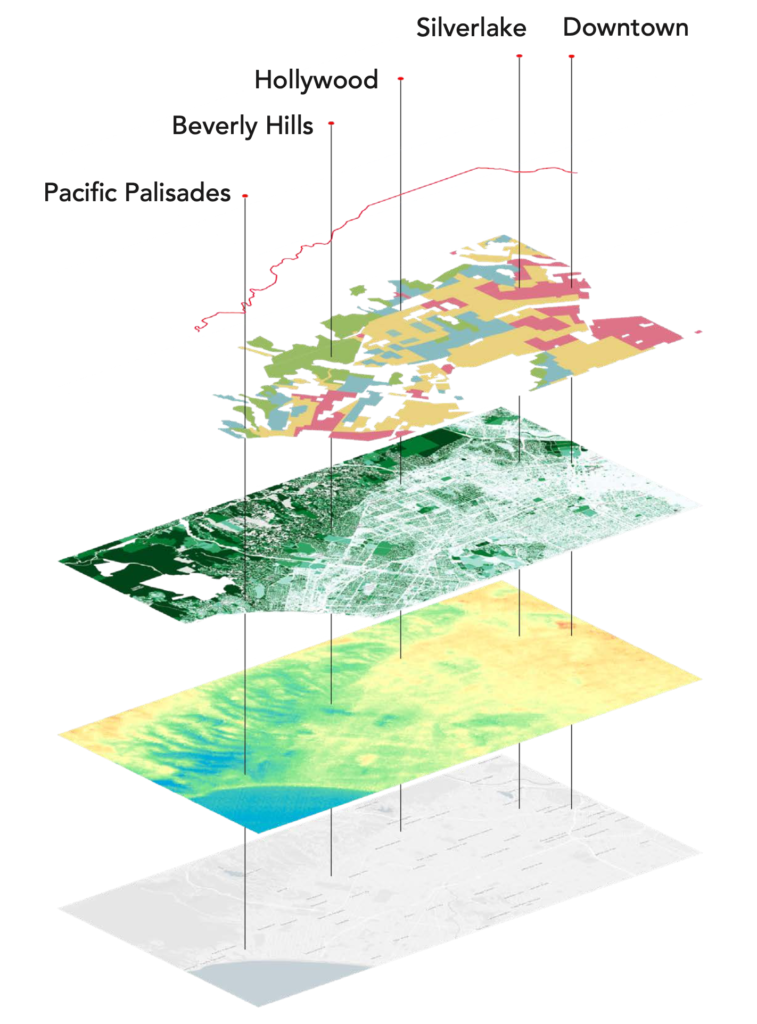
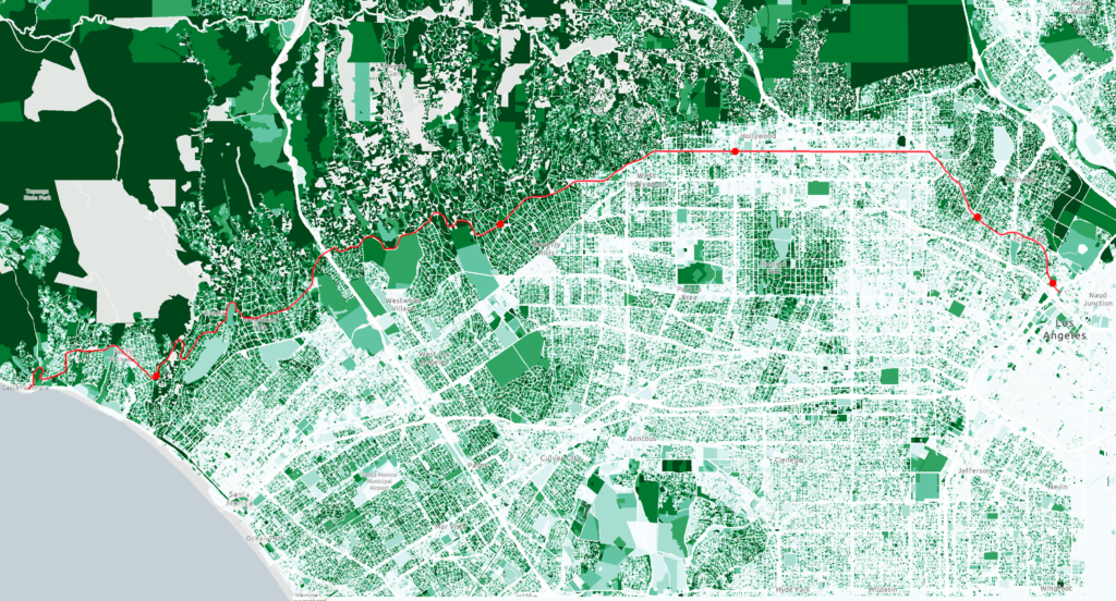
This project explores the socio-environmental causes of Los Angeles’ extreme heat. I pulled data from the NASA ECOSTRESS monitoring system, Tree People’s Tree Canopy Map, and the Home Owners’ Loan Corporation (HOLC) Los Angeles neighborhood risk assessment map to analyze the connection between systemic divestment and surface temperature. This project follows Sunset Boulevard, one of Los Angeles’ most iconic thoroughfares, as it bisects the city’s most and least resourced neighborhoods.
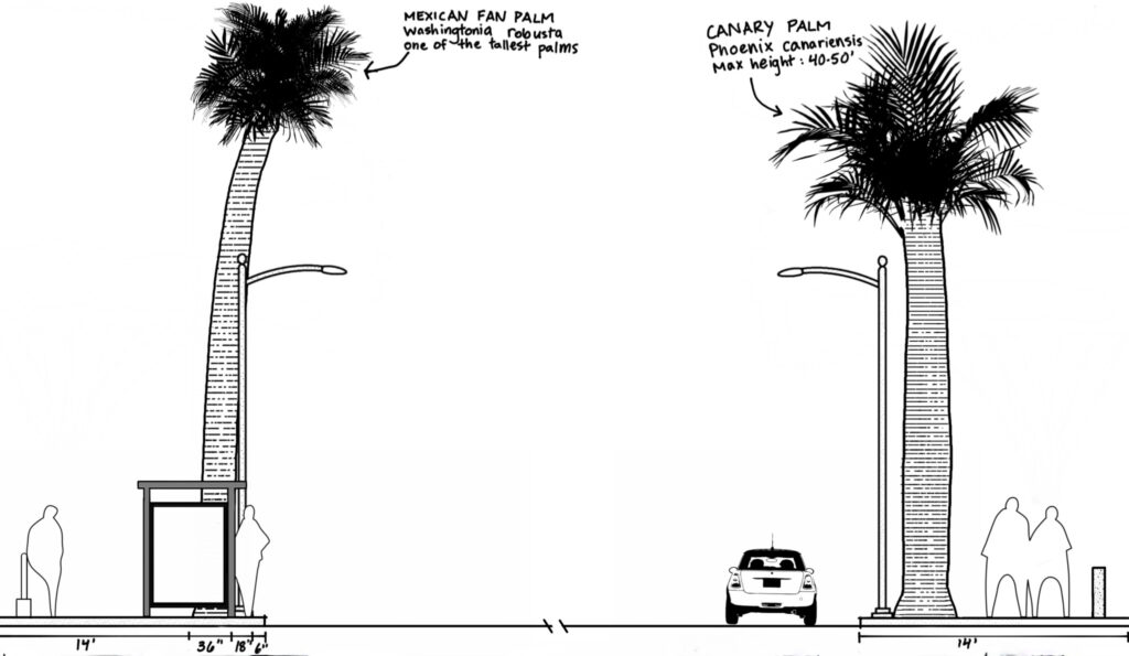
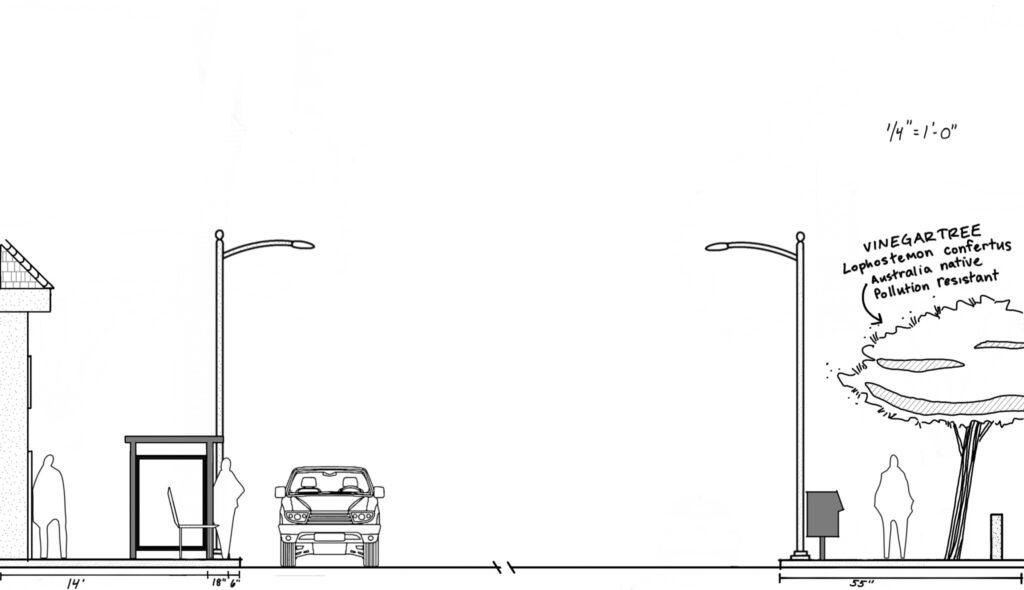
Tree Cover Studies
Not only did decades of discriminatory housing policies and practices create landscapes of violence, they created oppressively hot cities. Cities systemically divested in neighborhoods determined to be “redlined,” including reduced public facilities, resources, and public works. This included a dangerous lack of shade trees to line streets of these neighborhoods. The effects of redlining are felt, figuratively and literally, to this day. A lack of mature shade trees combined with an abudnance of dark, heat-absorbing asphalt create urban heat islands. Urban heat islands become heat danger zones, increasing the risk of heatstroke, dehydration, and fatal temperatures for residents. However, ambient temperature under shade is 7-10° cooler than temperature in the direct sun. Adequate, plentiful, and publicly accessible shade should be standard for municipal habitability requirements and code.
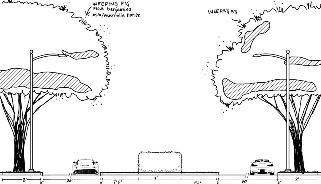
Sunset + Chatauqua
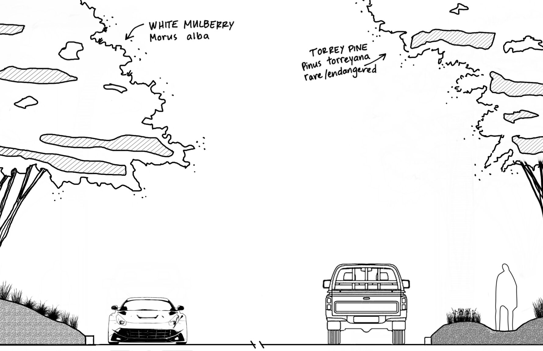
Sunset + Canon
Sunset + La Brea
Sunset + Occidental
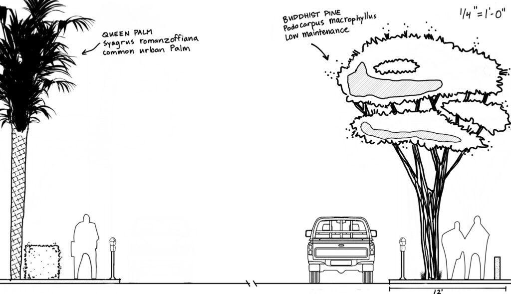
Sunset + Beaudry
HOLC Los Angeles Residential Security Map
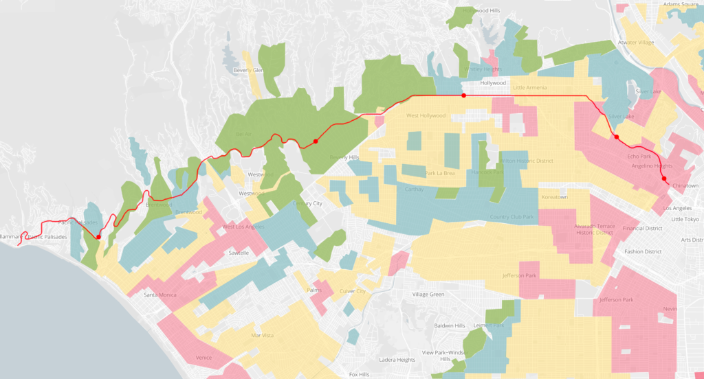
Tree People Tree Canopy Map
Temperature September 22, 2020: High: 90º/Low: 60º